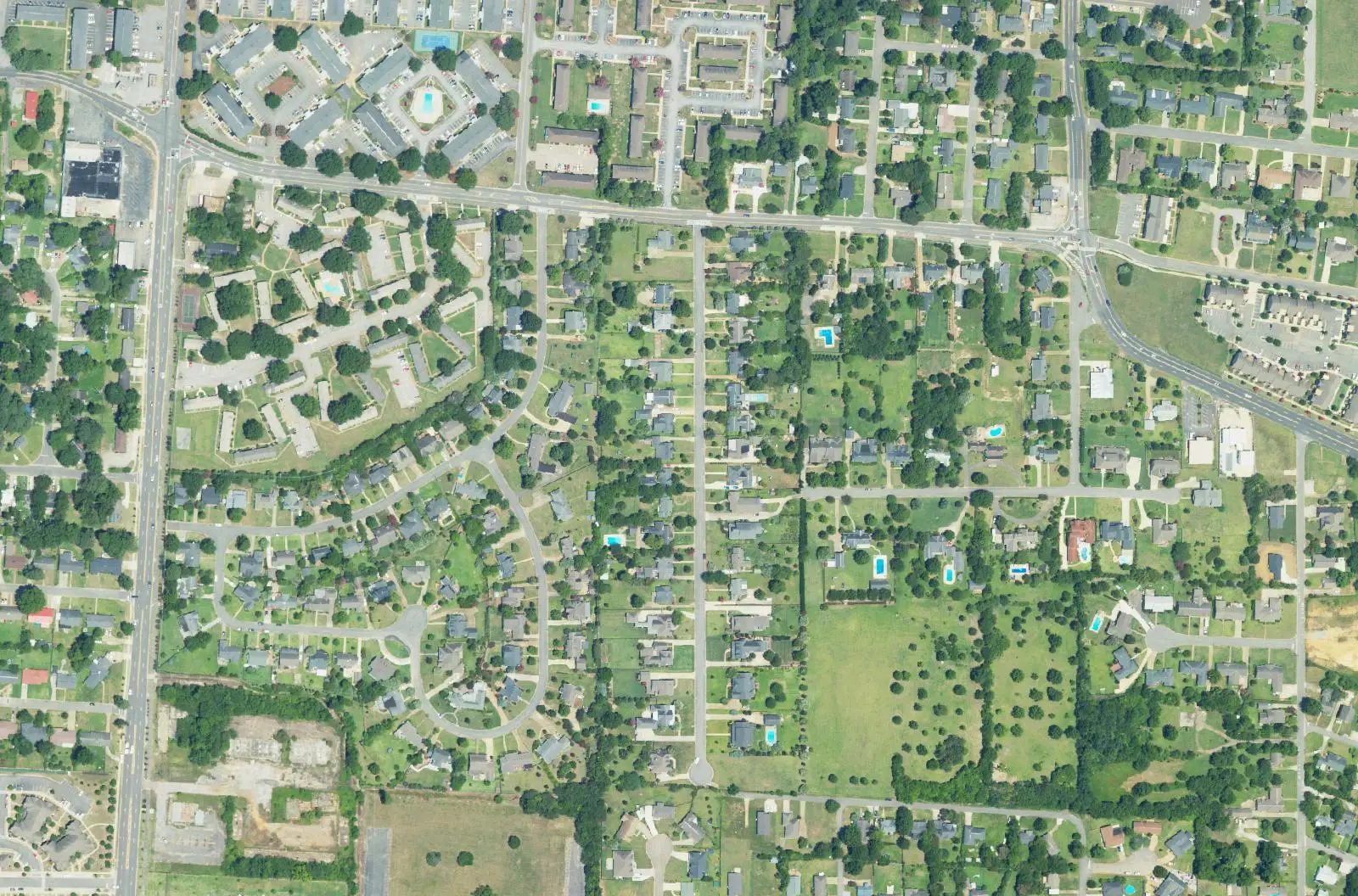
Glendale Gardens, Hillcrest and The Downs, three local historic districts off 10th Avenue and Hargrove Road, are in ZIP 35401, zoned for Central High.
Last checked Oct. 17, 2026. Sources: the City of Tuscaloosa’s historic districts map and Historic Preservation Commission page, its District 7 specific plan (April 2009) and parks layer; Tuscaloosa City Schools’ 2026-27 school zone map; the Alabama State Department of Education’s state report card; Zillow Research; the Tuscaloosa Transit Authority’s route pages; and OpenStreetMap.
Glendale Gardens, Hillcrest and The Downs are three neighboring residential areas just south of 15th Street, west of Hackberry Lane, each mapped by the city as a local historic district. They are mostly single-family houses, with apartment complexes along 10th Avenue and Hargrove Road at the edges.
What this means for you
- Zoned high school: Central High School (2025 state report card: 69, a D).
- Home value: $192,117 in ZIP 35401 in September 2026, according to the Zillow Home Value Index.
- Nearest interstate exit: I-359 Exit 1 (35th Street), about 1.4 miles by road.
- Who to call: City of Tuscaloosa Planning and the Historic Preservation Commission, 205-248-5100; Tuscaloosa City Schools, 205-759-3700.
Part of our Tuscaloosa neighborhoods guide.
Where it is
The city’s District 7 specific plan names The Downs, Glendale Gardens and Hillcrest as established neighborhoods in the northwest of that council district, next to 10th Avenue and Hargrove Road. (Council district lines have been redrawn since the plan was written in 2009.) The city’s historic districts map draws a Glendale Gardens, a Hillcrest and a Downs historic district side by side here.
For this guide we drew the area from 15th Street on the north south across Hargrove Road, between 10th Avenue on the west and Hackberry Lane on the east: about half a square mile, all inside city limits and in ZIP code 35401. The city provides police, fire and trash service.
Living in a historic district
Exterior work on a house in one of these districts, such as a new porch, fence, pool or windows, needs a certificate of appropriateness from the city’s Historic Preservation Commission. The commission’s Oct. 14, 2026, agenda included three Glendale Gardens cases: a rear porch, a pool and a pool with a garden shed. Staff are at 205-248-5100 and hpc@tuscaloosa.com.
Schools
Tuscaloosa City Schools’ boundaries follow city limits, and on its 2026-27 zone map every point we checked in the area falls in one zone:
| Level | School | 2025 score |
|---|---|---|
| Elementary | University Place Elementary, 2000 First Ave. | 88 (B) |
| Middle | Westlawn Middle, 1715 Martin Luther King Jr. Blvd. | 74 (C) |
| High | Central High, 905 15th St. | 69 (D) |
Scores are each school’s 2025 overall score, for the 2024-25 school year, on the Alabama State Department of Education’s state report card (choose 2024-2025, Tuscaloosa City and the school). Central High is on 15th Street at the area’s northern edge. More in our schools guide.
Home values
The typical home value in ZIP 35401 was $192,117 in September 2026, down 1.1% from $194,266 in September 2025, according to the Zillow Home Value Index. The index is a modeled typical value for the middle third of homes, not a sale price, and 35401 takes in downtown, West Tuscaloosa and most of the university area too, so it is only a broad guide to these neighborhoods. The citywide figure was $243,681, up 0.8%. More in our home prices guide.
Parks and trails
From the city’s parks layer:
- Monnish Park, at 15th Street and Hackberry Lane on the area’s northeast corner, with a walking trail and shelters.
- Harmon Park, with the Ironwood Shelter, and Rosedale Park, just west across 10th Avenue.
More in our parks and trails guide.
Getting around
- Interstate: I-359 Exit 1 (35th Street), about 1.4 miles by road; I-20/59 Exit 73 (U.S. 82), about 2.2 miles.
- Downtown: about 2.1 miles by road to City Hall, 2201 University Blvd.
- Airports: Tuscaloosa National Airport about 6.7 miles, Birmingham-Shuttlesworth International about 61 miles. Distances are on the OpenStreetMap road network, measured with the OSRM routing engine, not drive times.
- Buses: TTA’s Greensboro route stops on 10th Avenue and at Bent Tree Apartments inside the area, weekdays 5 a.m. to 6 p.m.
More in our getting around guide.
Groceries and everyday stores
From OpenStreetMap: Mr Chen’s Oriental Market, near 15th Street and Hackberry Lane at the northeast corner. The nearest supermarkets are the Piggly Wiggly at 1721 Greensboro Ave. and the Publix at 1190 University Blvd., both north of 15th Street.
How we drew this area
The city’s districts are small; this guide uses the streets between 15th Street, 10th Avenue and Hackberry Lane around them. School zones come from points spaced about 500 feet apart, checked against the district’s 2026-27 zone layer on Oct. 17, 2026. Store and place locations are © OpenStreetMap contributors.
Frequently asked questions
Where is Glendale Gardens in Tuscaloosa?
Glendale Gardens is south of 15th Street between 10th Avenue and Hackberry Lane, around Hargrove Road, next to the Hillcrest and Downs neighborhoods. The city maps all three as local historic districts.
Is Glendale Gardens a historic district?
The City of Tuscaloosa maps a Glendale Gardens Historic District, along with neighboring Hillcrest and Downs districts. Exterior changes there, such as porches, pools and fences, need a certificate of appropriateness from the Historic Preservation Commission.
What schools is Glendale Gardens Tuscaloosa zoned for?
University Place Elementary, Westlawn Middle and Central High, on Tuscaloosa City Schools’ 2026-27 zone map. Their 2025 state report card scores were 88, 74 and 69.
What is the typical home value in Glendale Gardens, Tuscaloosa?
The area is in ZIP code 35401, where the Zillow Home Value Index was $192,117 in September 2026. That ZIP code is much larger than Glendale Gardens and the index is a modeled typical value, not a sale price.
Have your say